
Colorado is entering yet another stretch of unseasonably warm, dry, and windy weather, creating conditions that forecasters describe as primed for rapid fire growth across the Front Range and Eastern Plains. While late February typically brings a mix of snow and cold, this week’s pattern has pushed temperatures into the 60s and 70s at lower elevations, dropped humidity into the single digits, and driven repeated rounds of gusty downslope winds. Together, these factors have kept much of the state under elevated or critical fire danger for several consecutive days.
Red Flag Warnings have been issued across portions of Southern Colorado, including the I‑25 corridor between Pueblo and Colorado Springs, where west‑northwest winds are strongest and the air is driest. Meteorologists note that humidity values have fallen as low as nine percent in some fire weather zones, a level more typical of early summer than late winter. Even in areas without active warnings, such as parts of the Denver metro, forecasters have declared First Alert Weather Days due to the likelihood of Red Flag conditions developing as winds increase again on Friday.
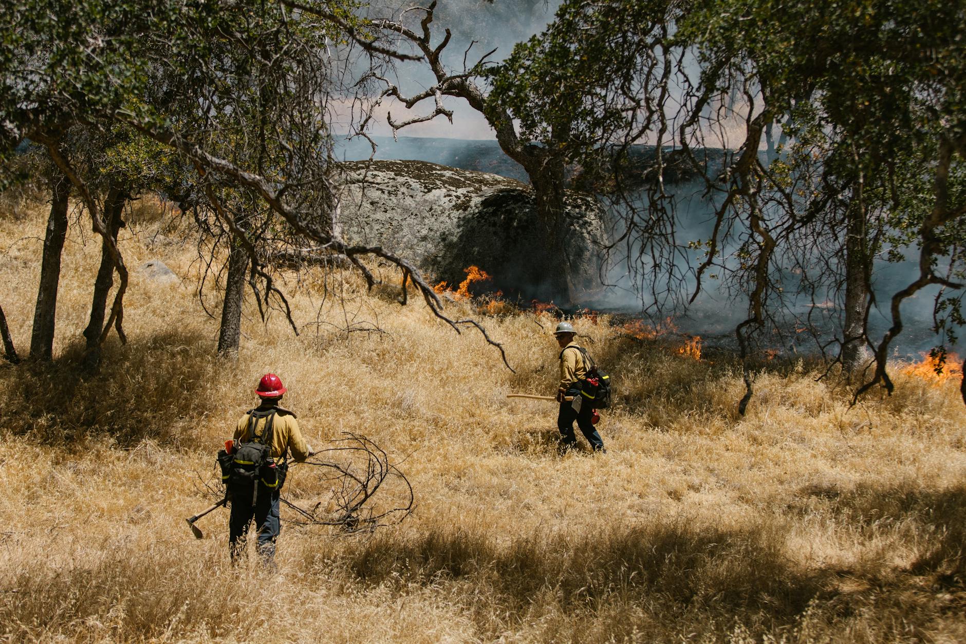
The highest concern lies in the combination of cured winter grasses and persistent downslope winds. Dormant fine fuels—especially the tall, dead grasses that blanket the plains—ignite easily and carry fire quickly when winds align. Downslope flow off the mountains compresses and warms the air, stripping away what little moisture remains and creating a corridor of heightened risk along the foothills and adjacent plains. This pattern has repeated several times this month, leaving lower elevations dry even as the high country continues to receive periodic snowfall.
Although Colorado is not currently facing a large, headline‑grabbing wildfire, fire officials emphasize that the danger lies in how quickly a small ignition can escalate. On days like these, a single spark from a dragging chain, a tossed cigarette, or a power tool can produce a fast‑moving grassfire capable of threatening homes and infrastructure within minutes. Strong, variable winds can push flames in unpredictable directions, while embers carried aloft may start new spot fires far ahead of the main front. This behavior complicates firefighting efforts and can force rapid evacuations, particularly in densely populated areas along the urban corridor.
Residents are urged to avoid any form of open burning, secure outdoor equipment, and postpone activities that generate sparks. Counties across the state have implemented or tightened burn restrictions, and fire agencies continue to stress the importance of preventing ignitions during this prolonged period of elevated risk. Real‑time fire maps and statewide smoke trackers remain valuable tools for monitoring new starts, especially as conditions shift quickly throughout the afternoon and early evening hours.
Looking ahead, the warm and windy pattern is expected to continue through Friday, with another round of Red Flag conditions likely in parts of the Front Range. Forecasters are watching for the arrival of a more substantial storm system that could bring moisture to lower elevations, but until that occurs, Colorado remains vulnerable to rapid fire spread. The state’s late‑winter fire seasons have grown increasingly common in recent years, and this week’s weather underscores how quickly the landscape can transition from winter calm to fire‑ready in a matter of hours.
Fire Danger Remains High Across Colorado as Warm, Wind‑Driven Pattern Persists
Discover more from
Subscribe to get the latest posts sent to your email.
Leave a Reply